Satellite got my Stinger, how?

MerlintheMad

10000 Posts Club!
Joined
Jun 2, 2018
Messages
18,799
Reaction score
7,063
Points
118
Location
West Jordan, Y00TAW
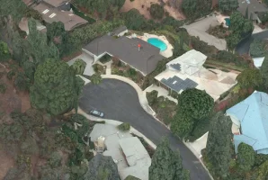
Our house, center-bottom; the two cars in the carport are my wife's Fusion and my Silky Silver. My question: how did Google satellite view pick up my car? I thought that the 3D zoom in angled views were generated by street views; which are created by the Google camera car going down each street 360 degree videoing. When you zoom in and it jumps to street view, our house still shows when we had two vans; even my wife's Fusion isn't there yet, so, the street views of our neighborhood haven't been updated since 2015.
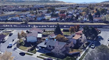
stinger 1st google.webp
 
The 3D/Globe view is primarily based on aerial imagery, much like Bing's Bird Eye. They may use street view data to patch up certain areas, but by and large its aerial stuff they license.

The 3D topography/building data is gathered from aircraft and drones using LIDAR.
 
A drone photographed the tail feathers of my Stinger? Learn something every day. :D
 
______________________________
Check the Apple Maps version. They use technology from cruise missiles to generate their imagery!

Screen Shot 2020-11-18 at 7.24.05 AM.webp
 
Check the Apple Maps version. They use technology from cruise missiles to generate their imagery!

View attachment 52532
Not going to lie, that looks like it came off of a 20 year old Nintendo game or I had some bad shrooms.
 
From interior to exterior to high performance - everything you need for your Stinger awaits you...
Not going to lie, that looks like it came off of a 20 year old Nintendo game or I had some bad shrooms.
Coincidentally, that's the house Quentin Tarantino rented for his newest movie, Once Upon a Time in Hollywood. Some areas that are flatter allow for more angles that the photogrammetry algorithms can stitch together into a better mesh. Still cool technology!
 
Back
Top