-
PLEASE! It is VERY important that this area is not used for the discussion of technical issues with your Stinger. This section is for posting about regional-specific things like Stinger clubs, events, local vendor or dealer recommendations, KiaStinger.com member sightings, etcetera... In other words, I do NOT want people to need to scour through several different sections to find answers about their heads up display. That's why there's a section dedicated specifically to discussions like that. THANK YOU!
-

You are using an out of date browser. It may not display this or other websites correctly.
You should upgrade or use an alternative browser.
You should upgrade or use an alternative browser.
Pictorial where did you go in your Stinger today
- Thread starter Stinger GT SS
- Start date
OliverNuther
1000 Posts Club!
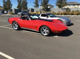
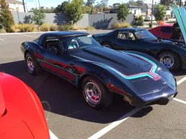
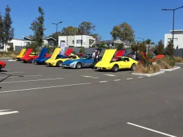
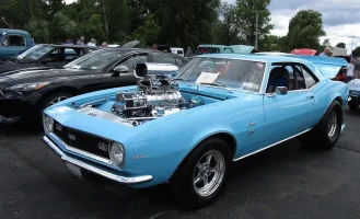
Iconic cars. Totally timeless.
Manaz
1000 Posts Club!
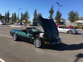
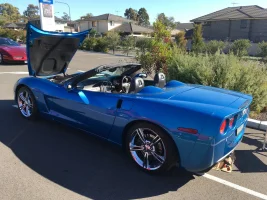
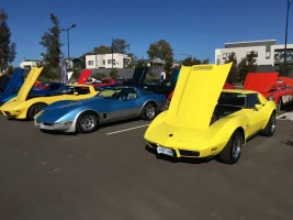
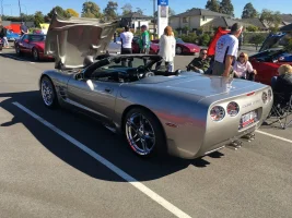
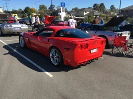
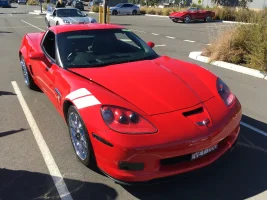
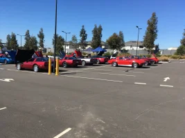
I didn't realise we had so many Corvettes in Sydney!
______________________________
Stinger GT SS
5000 Posts Club!
Yep & that’s just one club outing & one guy drove up from the ACT.I didn't realise we had so many Corvettes in Sydney!
From interior to exterior to high performance - everything you need for your Stinger awaits you...
MerlintheMad
10000 Posts Club!
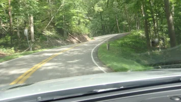
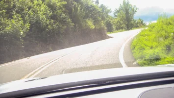
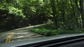
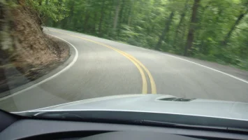
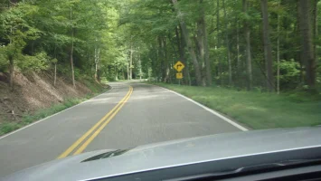
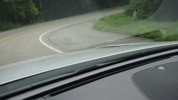
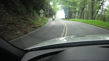
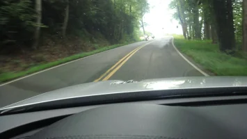
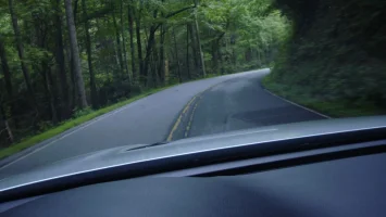
Today, I did "the Dragon": Tail of the Dragon, Hwy 129, where it crosses from Tennessee into N. Carolina. Gorgeous country. The road is well maintained but narrow. The sign says: Stay in your own lane. And No Passing. Go figure. 30 MPH posted speed limit for the entire 11 miles and 318 curves.
I ran it four times, so that's 44 miles and 1,272 curves. Mostly I kept my speed down. But by the halfway point in the third run, I was starting to feel ballsy. I put it in manual gate and kept my gears in 2nd and 3rd the whole time after that, with RPMs c. 3K to 4K (sometimes a little lower and higher than that): this allowed for quick recovery when I dived into a really tight corner a bit too hard: then the AWD could power out of it. I got a few "chirps" out of my Michelin summer tires. and just a bit of oversteer a few times. I only had to get out of motorcycles way twice; and twice motorcycles had to get out of my way. People are very polite to move aside rather than ruin somebody's run.
My last run, north to south, I had a black Bimmer on my tail pushing me up the road. But he didn't try to pass, and I don't think I was slowing him down much at all by that point. I signaled at the turn off to the scenic lookout point and he blatted away to enjoy the really twisty nine miles (I had only "danced" with him for the first two - north - miles).
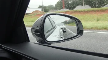
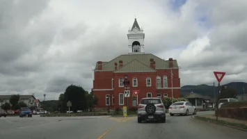
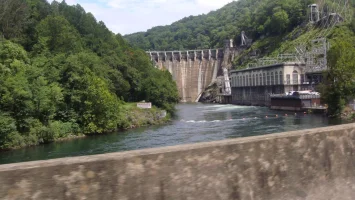
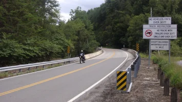
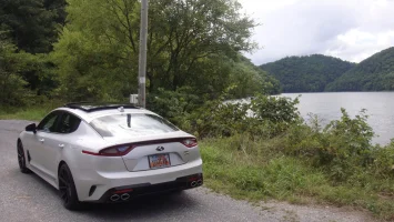
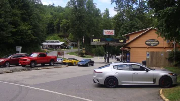
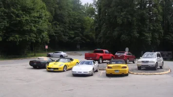
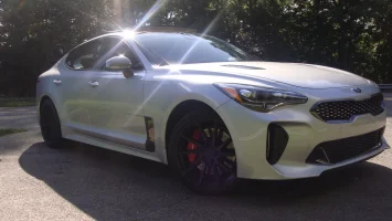
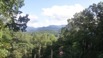


(row 1) I saw Stinger in the Wild number 14, on Hwy 19, on my way out this morning. The only round about, I forget which town this was. The dam on the Cheoah river. The north end of the Dragon. Ditto.
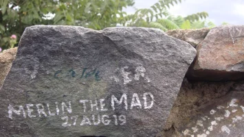
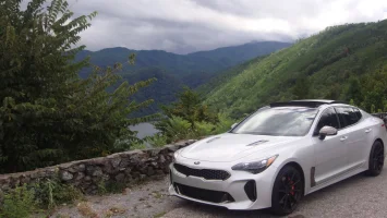
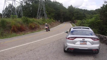
(row 2) I used my Silky Silver touchup paint to leave my moniker and the date. There are hundreds of these on the stones of the wall at the scenic lookout. Two pics of the scenic lookout (most riders turn around at this point, so says @eflyguy ) because the north two miles are not as interesting. Deal's Gap and an assortment of the cars that run the Dragon.
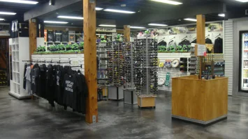
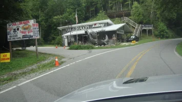
(row 3) Inside the Deal's Gap gift shop. I bought a long sleeved black T shirt and two hats. "Killboy" and their dragon statue. I don't know what kind of rivalry exists, if any, between the two souvenir shops
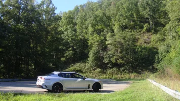
  . My car at another scenic lookout south of the Dragon.
Last two pics are panoramas of the Tail of the Dragon scenic lookout.
I ran it four times, so that's 44 miles and 1,272 curves. Mostly I kept my speed down. But by the halfway point in the third run, I was starting to feel ballsy. I put it in manual gate and kept my gears in 2nd and 3rd the whole time after that, with RPMs c. 3K to 4K (sometimes a little lower and higher than that): this allowed for quick recovery when I dived into a really tight corner a bit too hard: then the AWD could power out of it. I got a few "chirps" out of my Michelin summer tires.
My last run, north to south, I had a black Bimmer on my tail pushing me up the road.


(row 1) I saw Stinger in the Wild number 14, on Hwy 19, on my way out this morning. The only round about, I forget which town this was. The dam on the Cheoah river. The north end of the Dragon. Ditto.
(row 2) I used my Silky Silver touchup paint to leave my moniker and the date. There are hundreds of these on the stones of the wall at the scenic lookout. Two pics of the scenic lookout (most riders turn around at this point, so says @eflyguy ) because the north two miles are not as interesting. Deal's Gap and an assortment of the cars that run the Dragon.
(row 3) Inside the Deal's Gap gift shop. I bought a long sleeved black T shirt and two hats.
 "Killboy" and their dragon statue. I don't know what kind of rivalry exists, if any, between the two souvenir shops
 Last two pics are panoramas of the Tail of the Dragon scenic lookout.
Last edited:
Ozstung
5000 Posts Club!
A trip up the Blue mountains west of Sydney, not a long trip as I live on the bottom escarpment. Worked my way down to the Megalong valley down the bottom of the other side.
A pleasant twisty drive down and up stopped for a meal and finished off with some Scones, jam and cream.
The road down to the valley is extremely narrow had a view looneys think it a laugh to come around blind bends on my side. As you can see its quiet dry, in the midst of a drought.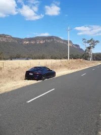
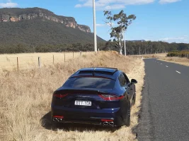
A pleasant twisty drive down and up stopped for a meal and finished off with some Scones, jam and cream.
The road down to the valley is extremely narrow had a view looneys think it a laugh to come around blind bends on my side. As you can see its quiet dry, in the midst of a drought.


And I was there two weekends ago! If anybody likes curves, this is the place to do it! The scenery and people make it great! You should get it figured out by your third run. Then it's up to you how hard you want to hit it! The 30mph speed limit is your reminder to keep it sane on public roads. But the tightness and switchback nature of the curves coupled with frequent dips and such make it absolutely amazing!Today, I did "the Dragon": Tail of the Dragon, Hwy 129, where it crosses from Tennessee into N. Carolina. Gorgeous country. The road is well maintained but narrow. The sign says: Stay in your own lane. And No Passing. Go figure. 30 MPH posted speed limit for the entire 11 miles and 318 curves.
I ran it four times, so that's 44 miles and 1,272 curves. Mostly I kept my speed down. But by the halfway point in the third run, I was starting to feel ballsy. I put it in manual gate and kept my gears in 2nd and 3rd the whole time after that, with RPMs c. 3K to 4K (sometimes a little lower and higher than that): this allowed for quick recovery when I dived into a really tight corner a bit too hard: then the AWD could power out of it. I got a few "chirps" out of my Michelin summer tires.and just a bit of oversteer a few times. I only had to get out of motorcycles way twice; and twice motorcycles had to get out of my way. People are very polite to move aside rather than ruin somebody's run.
My last run, north to south, I had a black Bimmer on my tail pushing me up the road.But he didn't try to pass, and I don't think I was slowing him down much at all by that point. I signaled at the turn off to the scenic lookout point and he blatted away to enjoy the really twisty nine miles (I had only "danced" with him for the first two - north - miles).
View attachment 30287 View attachment 30288 View attachment 30289 View attachment 30290 View attachment 30291 View attachment 30292 View attachment 30293 View attachment 30294 View attachment 30297 View attachment 30298 View attachment 30300 View attachment 30302 View attachment 30304 View attachment 30305 View attachment 30306 View attachment 30307 View attachment 30308
(row 1) I saw Stinger in the Wild number 14, on Hwy 19, on my way out this morning. The only round about, I forget which town this was. The dam on the Cheoah river. The north end of the Dragon. Ditto.
(row 2) I used my Silky Silver touchup paint to leave my moniker and the date. There are hundreds of these on the stones of the wall at the scenic lookout. Two pics of the scenic lookout (most riders turn around at this point, so says @eflyguy ) because the north two miles are not as interesting. Deal's Gap and an assortment of the cars that run the Dragon.
(row 3) Inside the Deal's Gap gift shop. I bought a long sleeved black T shirt and two hats."Killboy" and their dragon statue. I don't know what kind of rivalry exists, if any, between the two souvenir shops
. My car at another scenic lookout south of the Dragon.
Last two pics are panoramas of the Tail of the Dragon scenic lookout.
You certainly get better pictures than I do, Merlin! Well done!
MerlintheMad
10000 Posts Club!
There was only one "adventure" driving yesterday. And I learned a no brainer: DO NOT come up on the blind side of a semi: which is what the driver's side mirror is to him in a right hand curve. If I can't see his mirror he can't see me closing to pass. This produced the situation where he came over into the left lane, MY LANE, just as I was passing him, as he was getting ready to pass another truck in front of him. That was, of course, the whole reason why I appeared at speed: trying to get by him before he made his move. But I left my move a tiny bit too late. I was going pretty quick, as I moved onto the median shoulder and accelerated even faster. The left tires found the edge of the shoulder: and thank God it wasn't one of those where the edge drops off: and also thankfully the shoulder was actually wide enough for me to barely escape. (I'm sure the driver learned again to always check his mirror before making his move. And in fact, DO NOT pull out to pass on a right hand curve. Period. He can't see when someone trying to forestall him will suddenly be there.)
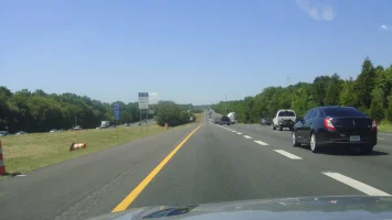
Here's a perfect situation: an HOV lane that isn't (it's after hours, so to speak); and perfect traffic.
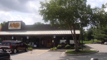
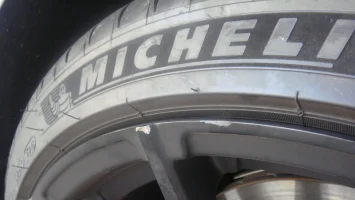
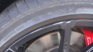
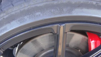
I took a good break in the middle of the day by stopping in St Joseph, MO. I debugged my car, ate lunch at the Cracker Barrel, then as I was approaching my car I noticed two shiny spots on the LR rim. Damnation! But, that's why I went with black rims: so I could get the touchup paint out and eliminate the glaring flaw. I know when this must have occurred: yesterday when I hung the edges of my outside (left) tires over the edge of that fortuitously placed WIDE shoulder: a rock or some other object snagged a rapid contact in passing. Cheap price to pay for a lesson learned! The shiny spot isn't metal, it's a reflection off the gloss black touchup paint.
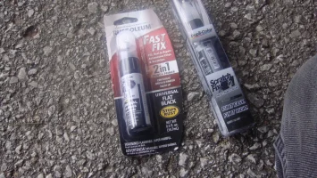
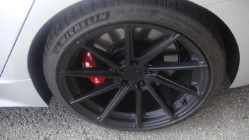
After touching up the spots on my rim, I took a walk around the mall parking lots across the street: I walked the entire perimeter of all those parking lots: it took c. forty minutes.
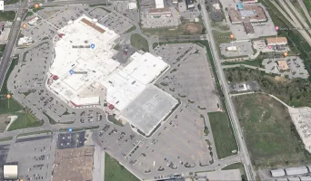
NAV directed me left out of the Cracker Barrel parking lot, and through the mall parking lot, then left again only a couple hundred yards further up the street from the Cracker Barrel entrance: why didn't "she" just have me turn right? I just laughed.
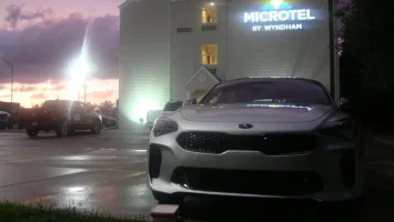
Here I am at the Microtel in Kearney, NE. Just as I was approaching, maybe three miles away, it rained copiously and briefly and got all the bugs off. It was very clean water, such that as I gassed up I used my microfiber wash towels to get the last of the most stubborn bug guts and then finished up with the drying towels: a free car wash from Mother Nature!
The lowering sun is deceptive: this was c. an hour before the rain. Then while it was raining the sunset burst below the clouds and through the falling rain right in my eyes as I tried to read the road signs and exit the freeway. That was very difficult, the worst lack of visibility I've experienced all this trip.
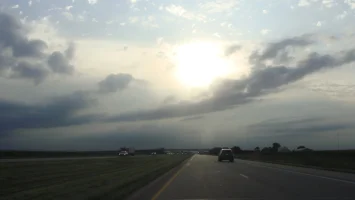
Here's a perfect situation: an HOV lane that isn't (it's after hours, so to speak); and perfect traffic.

I took a good break in the middle of the day by stopping in St Joseph, MO. I debugged my car, ate lunch at the Cracker Barrel, then as I was approaching my car I noticed two shiny spots on the LR rim. Damnation! But, that's why I went with black rims: so I could get the touchup paint out and eliminate the glaring flaw. I know when this must have occurred: yesterday when I hung the edges of my outside (left) tires over the edge of that fortuitously placed WIDE shoulder: a rock or some other object snagged a rapid contact in passing. Cheap price to pay for a lesson learned! The shiny spot isn't metal, it's a reflection off the gloss black touchup paint.


After touching up the spots on my rim, I took a walk around the mall parking lots across the street: I walked the entire perimeter of all those parking lots: it took c. forty minutes.

NAV directed me left out of the Cracker Barrel parking lot, and through the mall parking lot, then left again only a couple hundred yards further up the street from the Cracker Barrel entrance: why didn't "she" just have me turn right? I just laughed.
Here I am at the Microtel in Kearney, NE. Just as I was approaching, maybe three miles away, it rained copiously and briefly and got all the bugs off. It was very clean water, such that as I gassed up I used my microfiber wash towels to get the last of the most stubborn bug guts and then finished up with the drying towels: a free car wash from Mother Nature!
The lowering sun is deceptive: this was c. an hour before the rain. Then while it was raining the sunset burst below the clouds and through the falling rain right in my eyes as I tried to read the road signs and exit the freeway. That was very difficult, the worst lack of visibility I've experienced all this trip.


From interior to exterior to high performance - everything you need for your Stinger awaits you...
MerlintheMad
10000 Posts Club!
And, I am home. Got back early and washed my car in a hand wash facility. Used foam on the front. While drying off rims, I noticed a matching pair of scrapes to the LF rim: so, the LR damage was not because of the encounter with the edge of the road: these were caused by that damned, thrice bepoxed car wash "tunnel" in Atlanta. I do not know how to line up for a tunnel. I quickly touched up the spots and went to Costco, then home.
Driving through NE there were glorious patches of sunflowers.
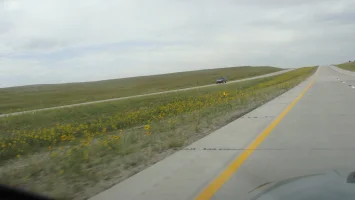
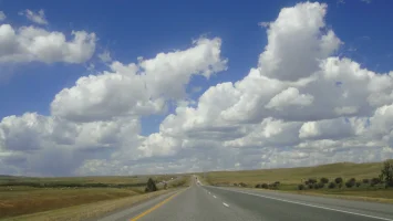
And in Wyoming the clouds were the dominant feature.
Here's a recap of yesterday's highlights (ironically the high point was at the end of my drive, i.e. after I got back to my home turf):
I got gas in western NE, where I was in great need to pee (a rhyme ), and at the end of the exit I found the stop sign upon me sooner than expected, because I was looking intently for the way over to that gas station; so I rather sailed around the corner on the edge, i.e. totally missed the stop (oh, I could have engaged the ABS by really standing on the brakes, but I so hate doing that). As I turned into the gas station I saw the lights going on top of the SUV in my rearview mirror. Damn, a cop. Oh, WELL??!! I pulled up to the pump and got out; and that was a big mistake. "Sir, could you get back into the vehicle. I won't argue with you." "I need to go really bad," I tried to explain. And he wasn't having any of it. The tenseness of the situation actually helped: the need to go diminished. He got my papers and let me go to the restroom. I started across the asphalt and then recollected: turning back I got my CCW permit out and handed it to him with an apology. "Are you carrying now?" He asked. And when I said yes, he said: "This is what I am talking about. That is why you should never exit the vehicle when you get pulled over. Here I am sitting in mine and here you are standing outside armed and I don't know you from Adam." I apologized again and said, "But I gave it to you!" (i.e. I didn't have to do that and just made more trouble for myself). When I came back to the car his sunglasses were up on his head and his eyes were bright and cheerful (and care worn). I began to have hope. (He had been so "coply" that I had muttered under my breath as I went to pee, "What a jerk!") The nature of our "conversation" changed. He said he was only giving me a warning. (! number four!) Then he asked about my car, said he'd seen them when he helped his son get an Optima: and he said he was looking at the Telluride. After a final injunction to obey stop signs, he wished me a good rest of my day.
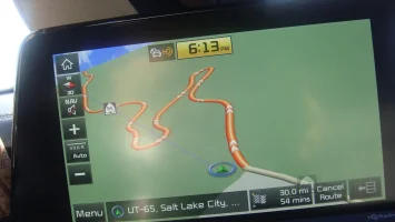
After I got gas in Nebraska (not sure, now, where that was) I noticed that NAV had adjusted the route without asking me. Instead of the straight shot to I-215 at the mouth of Parley's, "she" was telling me to get off I-80 and onto some road called "Pilot Butte", which is aka the "80 Business Loop". Well, I refused! NAV has been doing these things "on her own" and they are at times simply capricious. For example, the way she told me to turn left out of the Cracker Barrel driveway (see above). Now "she" seemed to be doing it again. "I refuse!" I said aloud. And when the loop exit came I went right on by, sticking to I-80. That was when I noticed that I had lost a full half hour of my projected travel time: instead of estimating home as something like c. ten to seven, now NAV said I was only going to get there at c. seven-thirty! WTH just happened?
Then I noticed that "she" was telling me to get off at something called the "Emory" exit. No amount of zooming in via the infotainment screen would show me an auxiliary road: it looked as if NAV was going to drive me off the freeway into a field or worse!? But, when I got there, the exit indeed existed and I took it. After losing my half hour, I recommitted to just letting NAV do the navigating. It's "her car", after all!? I just steer (when I'm not being doubting and stubborn).
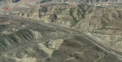
Things started to get interesting right away. The road parallels I-80 and in fact bears that designation: thus NAV's inability to show anything else. But there I was, galumphing along on a 40 MPH "highway" at something like 60 to 80 MPH: and the surface was dicey to almost bad but not quite bad enough to be scary. But why was I told to go HERE? The freeway traffic to my left was sailing along in that 80 MPH section and passing me up. This was supposed to be faster? I was not believing it but kept calm and waited to see what happened next. Still, I felt like Sid Ceasar in "It's a Mad, Mad ... World", watching from the biplane as the cars all went faster below.
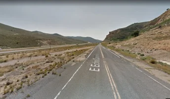
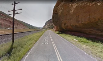
The cliffs came closer on my right until they literally overhung the road. It was starting to look Dr Seusian. I started to enjoy myself: a lot more than on the boring interstate.
'
Traffic was totally lacking till I neared the end of Echo Canyon Rd, then it started to come thick the other way, including an 18 wheel rig!? How in the world would it make the cliff overhang if it came the other way (my way, south)? Probably just barely gets under it.
I went through Henefer, without knowing what the name of the place was until I Googled it later. Henefer. Heh! It has always conjured up the ultimate "hick town" in Utah. The few people I've met from there are all hicks. But, I love hicks, I gotta say. It's pretty! Neat as a pin. I'd like living in Henefer.
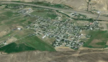
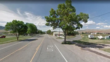
(The approach to Henefer involved one, final fubar by NAV - "she's" not infallible, go figure: A mysterious "turn to the left", marked by the approaching countdown in tenths of a mile, then feet, then 10', and NOTHING: the instant flashed by as if it had never been: had I been as the two guys in the "drive into a pond and blame it on Siri" video, I'd have ended up straddling the railroad tracks!? Heh!? And She wonders why I doubt her. It is a deepening relationship as we both feel our way forward. )
)
The road out of Henefer is UT-65. That struck a chord. And as soon as East Canyon Reservoir appeared everything became clear. "I was just here a little while ago!" I said aloud. "NAV, you gorgeous creature! You just want me to have FUN!" (In my metaphysical mind, She said: "Come with me, man-child, and I will show you where the twisty roads grow!" On top of that revelation: even with the delays to sight-see, I still got home when "she" said I would. I begin to feel like I live in a kind of time warp when I am with this car: maybe "she" is a Pooka.)
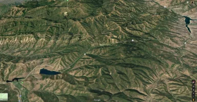
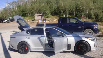
We twisted our way up the familiar switchbacks and curves, to the top, where I pulled off at the overlook (which I had completely overlooked before, heh). There was an outhouse which I made instant use of. Then I took pics. And I talked to a couple of motorcycle guys; one very experienced German-accented guy teaching a friend how to ride his new bike on "the twisty bits". He told ME about MY roads; exclaiming that although 65 is a fine road for fun, Pine Canyon Drive, between Midway and Guardsman Pass is the best.
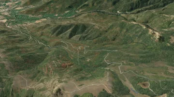
This I could readily agree with, having driven it recently myself. He spoke "glowingly" of the turn that is a decreasing radius and past the one-eighty point: I know about this curve! He said that bikers have been known to enter "too hot" and either fly off the road or lay the bike down, their only two choices. I'm sure I was grinning the whole time he was talking, because my mouth got tired. He finished up with: "Well, enjoy the 'twisty bits'."
Anyway! Great way to end four, count 'em four, long, full days of driving: starting with the Tail of the Dragon and finishing up with our own mini version of the same. Thank you NAV! You're my girl!
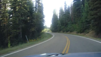
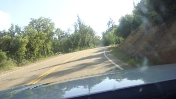
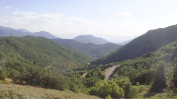

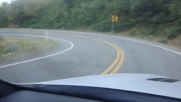
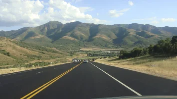
When 65 rejoined I-80, all the traffic was going up the canyon; rush hour-like density. On our side, hardly anything at all.
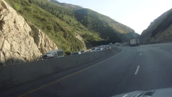
The irony of all this is, of course, that I just returned from a three day road trip, at the beginning end of which I drove Hwy 129 (Tail of the Dragon); only to be reminded when I got back, that I don't need to go anywhere to find great driving roads.


Driving through NE there were glorious patches of sunflowers.

And in Wyoming the clouds were the dominant feature.

Here's a recap of yesterday's highlights (ironically the high point was at the end of my drive, i.e. after I got back to my home turf):
I got gas in western NE, where I was in great need to pee (a rhyme
After I got gas in Nebraska (not sure, now, where that was) I noticed that NAV had adjusted the route without asking me. Instead of the straight shot to I-215 at the mouth of Parley's, "she" was telling me to get off I-80 and onto some road called "Pilot Butte", which is aka the "80 Business Loop". Well, I refused! NAV has been doing these things "on her own" and they are at times simply capricious. For example, the way she told me to turn left out of the Cracker Barrel driveway (see above). Now "she" seemed to be doing it again. "I refuse!" I said aloud. And when the loop exit came I went right on by, sticking to I-80. That was when I noticed that I had lost a full half hour of my projected travel time: instead of estimating home as something like c. ten to seven, now NAV said I was only going to get there at c. seven-thirty! WTH just happened?
Then I noticed that "she" was telling me to get off at something called the "Emory" exit. No amount of zooming in via the infotainment screen would show me an auxiliary road: it looked as if NAV was going to drive me off the freeway into a field or worse!? But, when I got there, the exit indeed existed

Things started to get interesting right away. The road parallels I-80 and in fact bears that designation: thus NAV's inability to show anything else. But there I was, galumphing along on a 40 MPH "highway" at something like 60 to 80 MPH: and the surface was dicey to almost bad but not quite bad enough to be scary. But why was I told to go HERE? The freeway traffic to my left was sailing along in that 80 MPH section and passing me up. This was supposed to be faster? I was not believing it but kept calm and waited to see what happened next. Still, I felt like Sid Ceasar in "It's a Mad, Mad ... World", watching from the biplane as the cars all went faster below.

The cliffs came closer on my right until they literally overhung the road. It was starting to look Dr Seusian.
 I started to enjoy myself: a lot more than on the boring interstate.

'
Traffic was totally lacking till I neared the end of Echo Canyon Rd, then it started to come thick the other way, including an 18 wheel rig!? How in the world would it make the cliff overhang if it came the other way (my way, south)? Probably just barely gets under it.
I went through Henefer, without knowing what the name of the place was until I Googled it later. Henefer. Heh!


(The approach to Henefer involved one, final fubar by NAV - "she's" not infallible, go figure: A mysterious "turn to the left", marked by the approaching countdown in tenths of a mile, then feet, then 10', and NOTHING: the instant flashed by as if it had never been: had I been as the two guys in the "drive into a pond and blame it on Siri" video, I'd have ended up straddling the railroad tracks!? Heh!? And She wonders why I doubt her. It is a deepening relationship as we both feel our way forward.
The road out of Henefer is UT-65. That struck a chord. And as soon as East Canyon Reservoir appeared everything became clear. "I was just here a little while ago!" I said aloud. "NAV, you gorgeous creature! You just want me to have FUN!" (In my metaphysical mind, She said: "Come with me, man-child, and I will show you where the twisty roads grow!" On top of that revelation: even with the delays to sight-see, I still got home when "she" said I would. I begin to feel like I live in a kind of time warp when I am with this car: maybe "she" is a Pooka.)

We twisted our way up the familiar switchbacks and curves, to the top, where I pulled off at the overlook (which I had completely overlooked before, heh). There was an outhouse which I made instant use of. Then I took pics. And I talked to a couple of motorcycle guys; one very experienced German-accented guy teaching a friend how to ride his new bike on "the twisty bits". He told ME about MY roads; exclaiming that although 65 is a fine road for fun, Pine Canyon Drive, between Midway and Guardsman Pass is the best.

This I could readily agree with, having driven it recently myself. He spoke "glowingly" of the turn that is a decreasing radius and past the one-eighty point: I know about this curve! He said that bikers have been known to enter "too hot" and either fly off the road or lay the bike down, their only two choices. I'm sure I was grinning the whole time he was talking, because my mouth got tired.
 He finished up with: "Well, enjoy the 'twisty bits'."
Anyway! Great way to end four, count 'em four, long, full days of driving: starting with the Tail of the Dragon and finishing up with our own mini version of the same. Thank you NAV! You're my girl!


When 65 rejoined I-80, all the traffic was going up the canyon; rush hour-like density. On our side, hardly anything at all.

The irony of all this is, of course, that I just returned from a three day road trip, at the beginning end of which I drove Hwy 129 (Tail of the Dragon); only to be reminded when I got back, that I don't need to go anywhere to find great driving roads.
Last edited:
MerlintheMad
10000 Posts Club!
MerlintheMad
10000 Posts Club!
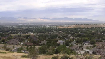
Today's outing was close by, less than 25 minutes away, up on the east bench. You can see the profile of Lake Bonneville's highest shoreline in this pic.
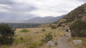
I had never heard of this suspension bridge before. It's only c. four years old. Without it, the Bonneville Shoreline Trail was interrupted by Bear canyon: you had to hike up the side of the canyon and back out (not a big inconvenience, as the distance of "detour" is only c. half a mile). I think the rools for bridge use are funny. They say no horses and bicyclists are to get off and walk; and, do not use the bridge in high winds.
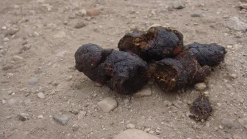
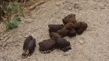
Clearly, the poop faeries are all on (perpetual) strike. I took these to document my disgust with people who think that their dogs are too precious to obey rools. These owners are destined to spend some purgatory time in "a very special place" until their sin is expiated: and I offer my pics as evidence to help convict them.
A video of the walking the bridge:
Dropbox - MOV08369.MPG - Simplify your life
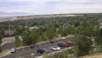
(row one) parking lot; approaching the suspension bridge; the full bridge; my wife "rocking" the bridge; dedicatory)
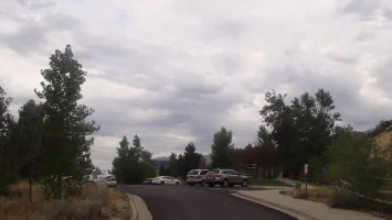
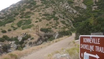
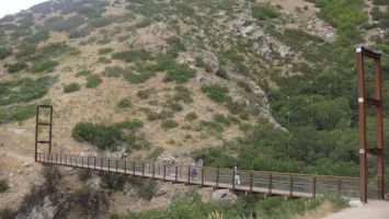
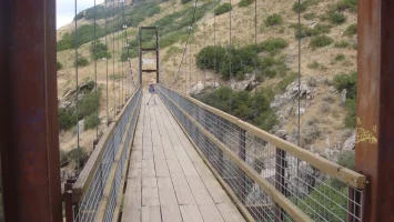
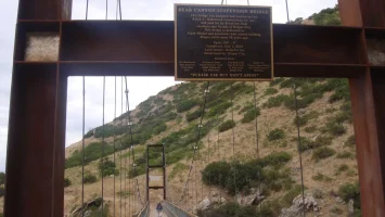
(row two) panorama of Salt Lake Valley from the middle of the suspension bridge; looking back at the south end of the bridge; couple of switchbacks above the parking lot; right above the parking lot.

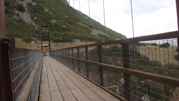

I had never heard of this suspension bridge before. It's only c. four years old. Without it, the Bonneville Shoreline Trail was interrupted by Bear canyon: you had to hike up the side of the canyon and back out (not a big inconvenience, as the distance of "detour" is only c. half a mile). I think the rools for bridge use are funny. They say no horses and bicyclists are to get off and walk; and, do not use the bridge in high winds.
Clearly, the poop faeries are all on (perpetual) strike. I took these to document my disgust with people who think that their dogs are too precious to obey rools. These owners are destined to spend some purgatory time in "a very special place" until their sin is expiated: and I offer my pics as evidence to help convict them.


A video of the walking the bridge:
Dropbox - MOV08369.MPG - Simplify your life
(row one) parking lot; approaching the suspension bridge; the full bridge; my wife "rocking" the bridge; dedicatory)


(row two) panorama of Salt Lake Valley from the middle of the suspension bridge; looking back at the south end of the bridge; couple of switchbacks above the parking lot; right above the parking lot.


AV8R
5000 Posts Club!
- Joined
- Dec 13, 2017
- Messages
- 7,325
- Reaction score
- 2,051
- Points
- 118
- Location
- Perth, Western Australia
I need a lie down now! Im exhausted. Lol
Nasscar
2500 Posts Club!
The Stinger and the Stingrays. Beautiful cars.Took the Stinger to meet some Stingrays this morning, some real classic muscle cars here.
Mine was in the naughty corner...lol but it got lots of looks & comments from Vette Owners & visitors alike, I also met another Stinger Owner, Deep Chroma Blue purchased from Peter Warren.
View attachment 30156 View attachment 30149 View attachment 30150 View attachment 30151 View attachment 30152 View attachment 30153 View attachment 30154 View attachment 30155 View attachment 30157 View attachment 30158
From interior to exterior to high performance - everything you need for your Stinger awaits you...
Nasscar
2500 Posts Club!
I don't need to go on holidays. I just follow Merlin's posts. OMG 
______________________________
Ozstung
5000 Posts Club!
....thats a full time job in itself.I don't need to go on holidays. I just follow Merlin's posts. OMG
Flameangel
2500 Posts Club!
I enjoy your pics, not so keen on the " dog crap ones ", after asking patient's the daily question of " have you used your bowels today ? " recording same and sometimes the blessed stool sample that is required, I don't want to see poop on the threads but I understand where your'e coming from.Today's outing was close by, less than 25 minutes away, up on the east bench. You can see the profile of Lake Bonneville's highest shoreline in this pic.
View attachment 30603
I had never heard of this suspension bridge before. It's only c. four years old. Without it, the Bonneville Shoreline Trail was interrupted by Bear canyon: you had to hike up the side of the canyon and back out (not a big inconvenience, as the distance of "detour" is only c. half a mile). I think the rools for bridge use are funny. They say no horses and bicyclists are to get off and walk; and, do not use the bridge in high winds.
Clearly, the poop faeries are all on (perpetual) strike. I took these to document my disgust with people who think that their dogs are too precious to obey rools. These owners are destined to spend some purgatory time in "a very special place" until their sin is expiated: and I offer my pics as evidence to help convict them.
View attachment 30604 View attachment 30621
A video of the walking the bridge:
Dropbox - MOV08369.MPG - Simplify your life
(row one) parking lot; approaching the suspension bridge; the full bridge; my wife "rocking" the bridge; dedicatory)
View attachment 30602 View attachment 30605 View attachment 30606 View attachment 30607 View attachment 30608
(row two) panorama of Salt Lake Valley from the middle of the suspension bridge; looking back at the south end of the bridge; couple of switchbacks above the parking lot; right above the parking lot.
View attachment 30622 View attachment 30618 View attachment 30619 View attachment 30620

Ozstung
5000 Posts Club!
Agreed I thought it was a crappy post toI enjoy your pics, not so keen on the " dog crap ones ", after asking patient's the daily question of " have you used your bowels today ? " recording same and sometimes the blessed stool sample that is required, I don't want to see poop on the threads but I understand where your'e coming from.

 .
.MerlintheMad
10000 Posts Club!
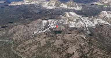
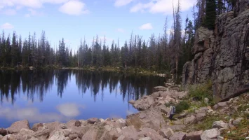
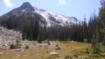
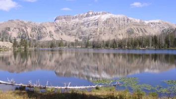
Excellent weather in the Uinta Mountains today (weather roulette; we had torrential rain and mixed hail yesterday and it snowed up there). We parked at the Ruth Lake trailhead and hiked to Ruth lake, over to Hayden Lake (the one at the base of Mount Marsell; this is misleading: as the marked peak is actually to the west of the part of Marsell where Hayden Lake is, which is to the left: I gather that entire mountain is "Marsell" and only the highest part gets labeled), then past an unmarked lake called Liberty, which unaccountably had a sign marking it and the shared year of our birth (what are the chances?); and went around Jewel Lake and then hiked back out past several other lakes; you can see them all more or less in the center of the Google Maps view, to the right of Ruth Lake:
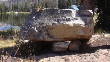
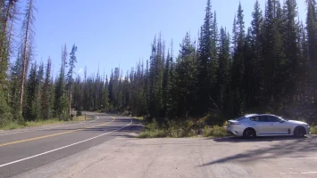
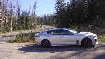

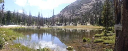
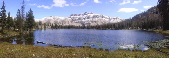
I have one question, about pic three in the first row: what the hell is going on with this rock sitting on top of half a dozen or so smaller rocks? This is not natural, so who and when did this? There's absolutely no access to this spot; the nearest road of any kind is a mile and a half away. That massive rock must weigh a couple of tons at the very least; each of the "table leg" rocks would be nigh on a hundred pounds. Fine. There it is for all to marvel at. I wonder how many people actually notice that this is impossible in nature?


I have one question, about pic three in the first row: what the hell is going on with this rock sitting on top of half a dozen or so smaller rocks? This is not natural, so who and when did this? There's absolutely no access to this spot; the nearest road of any kind is a mile and a half away. That massive rock must weigh a couple of tons at the very least; each of the "table leg" rocks would be nigh on a hundred pounds. Fine. There it is for all to marvel at. I wonder how many people actually notice that this is impossible in nature?
Last edited:
From interior to exterior to high performance - everything you need for your Stinger awaits you...

